Coastal Monitoring
Multi-source data fusion — satellite, drone and ground sensors — for real-time coastal flood monitoring, erosion tracking and shoreline change detection.
Early warning where it matters most.
Where we make the difference
Multi-source data fusion — satellite, drone and ground sensors — for real-time coastal flood monitoring, erosion tracking and shoreline change detection.
Early warning where it matters most.
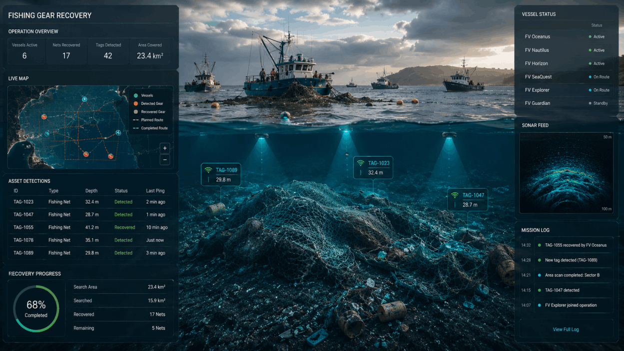
AI-assisted sonar and underwater vision systems for seabed mapping, lost cargo detection and marine debris recovery.
Built for offshore and coastal operations where precision and sustainability intersect.
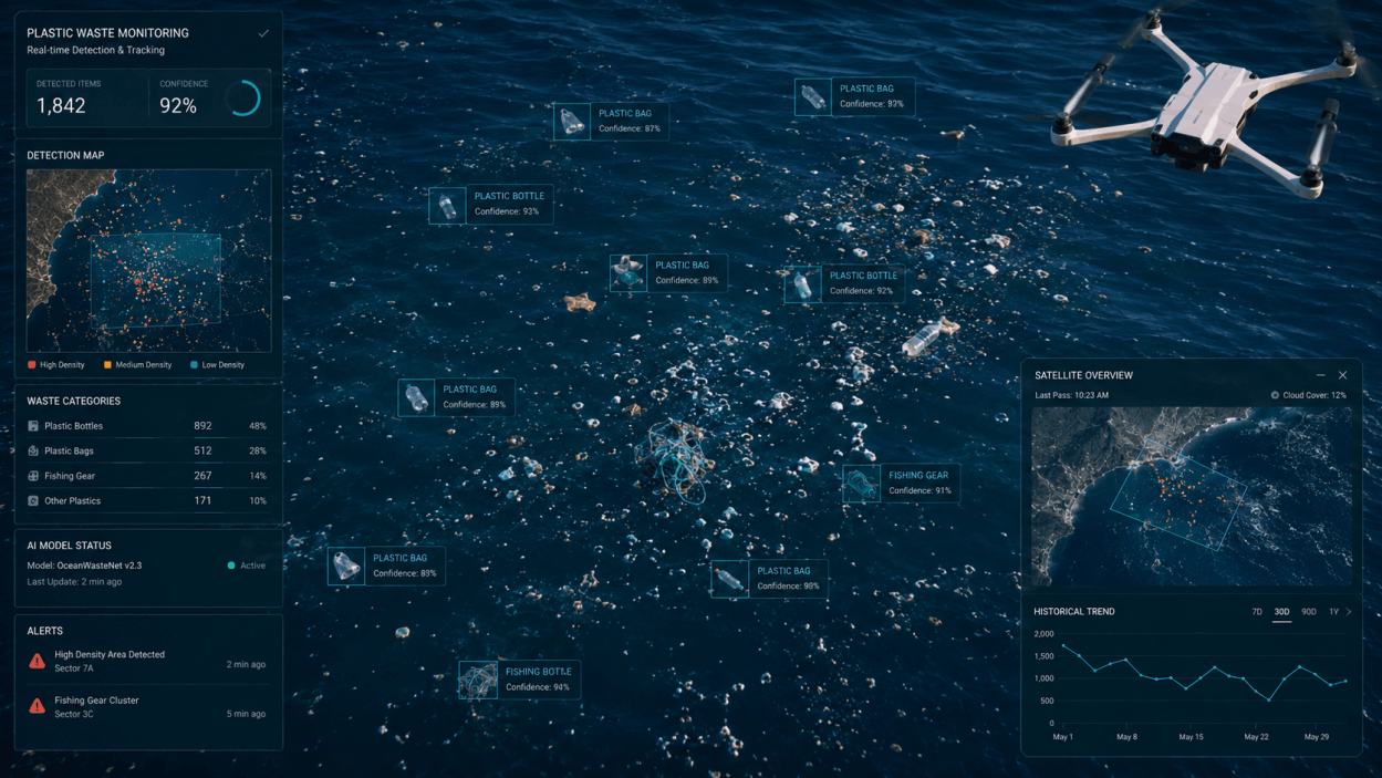
Optical and hyperspectral sensing systems deployed on vessels and drones to detect surface plastics, monitor marine species distribution and track ecosystem
health indicators in coastal and open water environments.
Technologies
Satellite & Earth Observation
GIS & Multi-Site Parcelling
AI Data Fusion

© Copyright 2025. TR2 srls All Rights Reserved